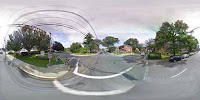
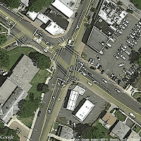
I'm working on a project where we need to know where people are and we need to tell people where to meet. I thought it would be handy to give people a picture of the places they would be going ahead of time. I adjusted the php script from a previous blog post and adapted it to connect to my database to find pictures of all of the places of interest. Using the Google Static Maps API and the Google Street Views API I was able to download the panoramic+satellite images of major bus stops in New Jersey. Here are some of the pictures below with the code pasted at the bottom.
If you just plug-in the latitude and longitude of the location of interest, you can download the panoramic and satellite images of the location. The thumbnails of the Google Street Views are limited to 400 x 218 pixels. I use this map a lot to quickly find the latitude/longitude of a location
http://bit.ly/ns0MPb.


No comments :
Post a Comment